Indoor Positioning with Ultra-wideband
Indoor tracking in industrial environments often requires very precise localization. For this purpose we offer solutions based on the short-range radio technology Ultra-wideband (UWB). It does not work with consumer standards such as Wi-Fi and Bluetooth Low Energy, but offers an accuracy better than 30 cm.
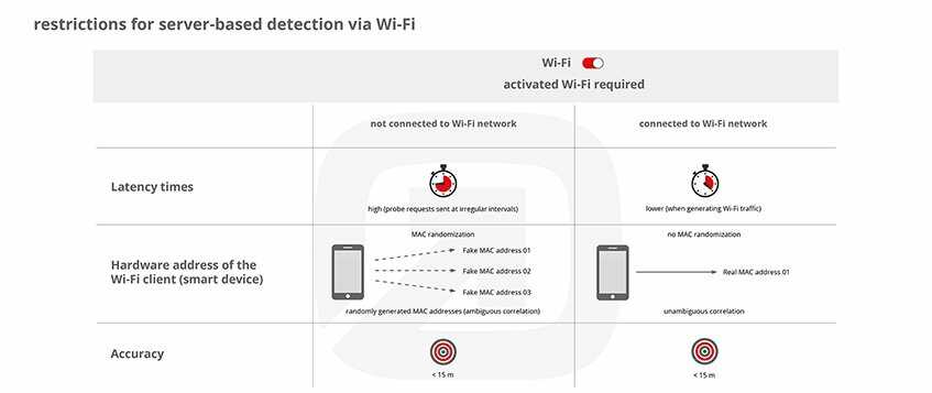
Indoor positioning with Ultra-wideband has some significant advantages: The accuracy is 10-30 cm, which is considerably better than when working with beacons (1-3 meters) or Wi-Fi (5-15 meters). Latency time is very low (position request up to 100 times/second). Height differences can be measured accurately. However, the technique is a special solution which requires appropriate components and thus is mostly suitable for special industry applications.
Functionality of Indoor Localization with Ultra-wideband
Ultra-wideband is a short-range radio technology which can be used for indoor positioning. In contrast to Bluetooth Low Energy and Wi-Fi, positioning is done with transit time methodology (Time of Flight, ToF) instead of the measurement of signal strengths (Receive Signal Strength Indicator, RSSI). This method measures the running time of light between an object and several receivers (anchors – infsoft Locator Nodes). For the exact localization of an object at least 3 receivers are necessary (trilateration). Also, there must be direct line-of-sight between receiver and transmitter.
The object to be tracked (asset) is equipped with a small tag (infsoft Locator Tag) which runs on battery power or draws its power via a forklift, for example. It sends data (ID, ToF, timestamp) to the infsoft Locator Nodes. The nodes have a fixed position in the infrastructure and can use the running time of light to calculate the distance of the asset. Combining the data of 3 Locator Nodes or more results in a positioning accuracy of 10-30 cm.
Setting up an UWB-Based System: Two Approaches
SERVER-BASED

Visualization of positioning data in the backend, no display on a client (smartphone).
In order to localize assets, the infsoft Locator Tag measures the distance to several infsoft Locator Nodes and sends the data back to them. infsoft Locator Nodes are modularly structured and have an integrated UWB module, which lets them act as a receiver. The infsoft Locator Node processes the data it receives and sends them to the infsoft LocAware platform® via Wi-Fi, Ethernet or UMTS. Here, the position is displayed for example on a map.
CLIENT-BASED

Visualization of positioning data on a client (smartphone) and if necessary transmission to the backend.
If the positioning data should be immediately displayed on a mobile device (smartphone), the infsoft Locator Tags can communicate with the smartphone via Bluetooth or USB interface directly. Time of Flight is measured, just like explained above, but the Locator Tag exchanges the data with the device via Bluetooth or USB port. The data can be sent to the infsoft LocAware platform® from the device, if necessary.
Technical Features of Ultra-wideband
- Usage of extremely wide frequency bands with a bandwidth of at least 500 MHz
- Almost no interferences
- Frequency bandwidth 3,1 – 10,6 GHz
- Transmission power 0,5 mW / −41,3 dBm/MHz
- Reach 10 – 150 m (depends on the use case)
- Data rate 110 kbit/s – 6.8 mbit/s
infsoft Locator Node: The infsoft Locator Node works as an anchor and a gateway and transmits the data of the Tag to the infsoft LocAware platform®. Within server-based installations, positioning happens there. More info on infsoft Locator Nodes.
infsoft Locator Tag: Transmitter based on UWB technology, which is attached to people or objects. It runs on batteries and transmits data for positioning to the infsoft Locator Nodes. More info on infsoft Locator Tags.
Use Cases for Locating Systems Using Ultra-wideband
Indoor/outdoor positioning with Ultra-wideband can be used in various application scenarios. Here are some examples:


